|
|
|||||||||
| Software: RF Cascade Workbook | RF Symbols for Office | RF Symbols & Stencils for Visio | Espresso Workbook | ||||||||||
|
|||||||||||||||||||||||||||||||
   |
  |
||||||||||||||||||||||||||||||
|
Please Support RF Cafe by purchasing my ridiculously low-priced products, all of which I created. RF & Electronics Symbols for Visio RF & Electronics Symbols for Office RF & Electronics Stencils for Visio T-Shirts, Mugs, Cups, Ball Caps, Mouse Pads These Are Available for Free |
|||||||||||||||||||||||||||||||


FPV Drone Tour of the Russian Duga-1 OTH Radar Antenna
Videos for
Engineers

 This archive links to the many video and audio
files that have been featured on RF Cafe.
This archive links to the many video and audio
files that have been featured on RF Cafe.
1 |
2 | 3 |
4 | 5
| 6 |
7 | 8 |
9
10 |
11 |
12 |
13 |
14 |
15 |
16 |
17 |
18 |19 |
20 |
21 |
22
23 |
24 |
25 |
26 |

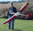
Drone FPV pilot Tommy Tibajia [@UmmaGawd] flying the DUGA-1 antenna
Radio controlled drones have gotten a bad name, mostly due to moronic operators that have no regard for other people's privacy or safety. I would like to be able to say those types are in the minority, but unfortunately they probably do make up the majority of drone owners. That is because unlike with R/C airplanes and helicopters which require at least a modicum of skill and common sense to fly successfully, even the cheapest drones incorporate stability systems that make flying them so easy a caveman can do it.

DUGA-1 over-the-horizon (OTH) radar antenna array

Drone's-eye view of DUGA-1 antenna from the top.

Conical radiating elements of the DUGA-1 OTH radar antenna array
At the opposite end of the drooling loser contingent of the drone pilot spectrum is the rapidly growing number of highly skilled pilots that advance not just the state of the art in flying techniques, but also in hardware development. As with all things, large scale adoption by the consumer public leads to a rapid product improvement cycle that brings more features and/or lower cost: Capitalism at its finest. Cellphone and drones are at the forefront of such a phenomenon, and not surprisingly, the technologies behind the two are shared. GPS and triangulation location determination, wireless connectivity, high resolution imaging, orientation detection (in space - not the other kind), artificial intelligence, simplified user interface with feedback, are a few examples.
First Person View (FPV) operation is the ultimate confluence of all cutting-edge technology and operator skill. FPV flight involves the pilot donning a pair of goggles incorporating a digital display screen and sometimes headphones that present information real-time from the drone platform. Aided by superimposed telemetry data, the pilot flies the drone as if he/she was actually aboard the craft - albeit as though he/she has one eye closed (no depth perception) and is wearing blinders (restricted field of view). High speed flight can be problematic if the frame update rate is not high enough. Dangers to life and property are significant due to the sharp, high speed propellers and often significant mass/momentum of the models. The Federal Aviation Administration (FAA) has only recently begun issuing regulations codifying how, when, where, and by whom Small Unmanned Aircraft Systems (sUAS) may be operated. Commercial operators and hobbyists are covered under separate requirements, thankfully.
Commercial applications of drones include aerial photography (still and video) by real estate and promotional companies to detailed visual inspection of equipment by cellphone companies (for towers), electrical distribution and other utilities (lines and transformers), construction contractors (roof and multi-story buildings), and even event videography (weddings, sports, ceremonies). This is work that heretofore required renting helicopters, portable elevated platform rigs, and telegraphic lenses on cameras positioned at remote elevated positions. Operators are required to carry specialized liability insurance and in many cases FAA-issued licenses.
Hobby (non-commercial) operation of drones, by far the most numerous scenario, now requires the pilot to register with the FAA prior to flying any remotely controlled aircraft - airplanes, helicopters, and drones. A long, expensive battle by the Academy of Model Aviation (AMA) is to be thanked for the distinction between commercial and recreational use of R/C models. The FAA tried underhandedly - and fortunately unsuccessfully - to lump both into the same highly regulated category. AMA membership comes with $2M of liability insurance and exempts the member from needing to display the FAA registration number on his/her aircraft if his/her AMA number is already present. I registered back in December of last year when doing so was free.
This video provides an amazing close-up tour of the decommissioned DUGA-1 over-the-horizon (OTH) radar antenna array in the Ukraine, near Chernobyl (of melt-down fame in 1986*). You might want to down a Dramamine before watching if you are prone to motion sickness and/or high altitude anxiety.
From the YouTube page:
Duga (Russian: Дуга) was a Soviet over-the-horizon (OTH) radar system that operated from July 1976 to December 1989... Now let's go dive it!!
Pilots / Hosts
- Tommy Tibajia [UmmaGawd]
- Steele Davis [Mr Steele]
- Chad Nowak [FinalGlideAUS]
- Kevin Dougherty [StingersSwarm]
Production Team
- Chad Kapper - Director / Executive Producer
- Christian Kapper - Editor / Camera
- André Elb - Camera
- Chad Kapper - Phantom 4 Camera
- Artem Korban
- David Windestal - https://rcexplorer.se/
- Giacomo Di Muro - https://youtube.com/c/giacowhatever
Special thanks to our sponsors
- Immersion RC
Anthony Cake and Sander Sassen
- Ukrainian Association of Drone Racing (UADR)
Oleksii Kliuk
Oleksiy Yermilov
Illya Dashyvets
Modest Podcepkin
Dmitriy Aksyonov
* My electromagnetics professor, Dr. Ken Golden, PhD, at the University of Vermont (I was in the UVM class of 1989, BSEE), had a son in Chernobyl at the time of the incident.
FPV Quadcopter Racing at the Drone Nationals
Posted August 4, 2016

Copyright: 1996 - 2026 |
About RF Cafe RF Cafe began life in 1996 as "RF Tools" in an AOL screen name web space totaling 2 MB. Its primary purpose was to provide me with ready access to commonly needed formulas and reference material while performing my work as an RF system and circuit design engineer. The World Wide Web (Internet) was largely an unknown entity at the time and bandwidth was a scarce commodity. Dial-up modems blazed along at 14.4 kbps while tying up your telephone line, and a lady's voice announced "You've Got Mail" when a new message arrived... |
Copyright 1996 - 2026 All trademarks, copyrights, patents, and other rights of ownership to images
and text used on the RF Cafe website are hereby acknowledge My Hobby Website: My Daughter's Website: |