

RF Cascade Workbook for Excel
RF & Electronics Symbols for Visio
RF & Electronics Symbols for Office
RF & Electronics Stencils for Visio
RF Workbench
T-Shirts, Mugs, Cups, Ball Caps, Mouse Pads
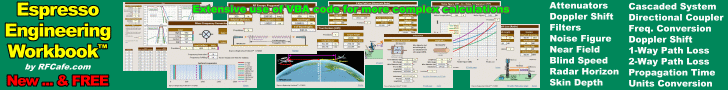
Espresso Engineering Workbook™
Smith Chart™ for Excel
|
 |
Cartography (Mapmaking) and
Geographic Information Systems (GIS) Resources |
Cartography (Mapmaking) and Geographic Information System (GIS) Products & Services
AGI GIS Dictionary (Original Edition)
This is the original edition of the dictionary of GIS terms, brought to you by the University Of Edinburgh Department of Geography and the Association for Geographic Information.
British Cartographic Society (BCS)
A dynamic association of individuals and organisations dedicated to exploring and developing the world of maps.
Cartographic Images
Time charts of cartography and numerous cartography links.
Cartography and Geographic Information Society
Supports research, education, and practices to improve the understanding, creation, analysis, and use of maps and geographic information to support effective decision-making and improve the quality of life.
Cartography Specialty Group
Activities, competitions, newsletters, links.
Croatian Cartographic Society (CCS)
A society of not only professionals but other people that show special interest in cartography.
David Rumsey Historical Map Collection
Focuses primarily on cartography of the Americas from the 18th and 19th centuries, but also has maps of the World, Asia, Africa, Europe, and Oceania. The collection includes atlases, globes, school geographies, books, maritime charts, and a variety of separate maps, including pocket, wall, children's and manuscript.
Dictionary of Abbreviations and Acronyms in Geographic Information Systems, Cartography, and Remote Sensing
This dictionary decodes abbreviations and acronyms found in various publications including maps and websites. These abbreviations or acronyms, therefore, are not necessarily authoritative or standardized in format or content.
Geographic Resources Analysis Support System
A Geographic Information System (GIS) used for geospatial data management and analysis, image processing, graphics/maps production, spatial modeling, and visualization.
GIS Dictionary
The dictionary includes definitions for 980 terms compiled from a variety of sources which either relate directly to GIS or which GIS users may come across in the course of their work.
|
| International Cartographic Association (ICA)
Promotes the discipline and profession of cartography in an international context..
Map History / History of Cartography
Old maps, early maps - non-current maps in general - are the subject of this site.
Mathematics of Cartography
Map making information including history, mathematics usage, problem solving, by Cynthia Lanius.
Micronational Cartography Society
A non-profit on dedicated to providing a contiguous map for micronations based solely within cyberspace.
National Cartography and Geospatial Center (NRCS)
Geospatial datasets, digital elevation data, GIS training, status maps.
National Center for Geographic Information and Analysis
An independent research consortium dedicated to basic research and education in geographic information science and its related technologies, including geographic information systems (GIS).
North American Cartographic Information Society
An organization comprised of specialists from private, academic, and government organizations whose common interest lies in facilitating communication in the map information community.
Society of Cartographers
Supports and encourages all those involved in the production of maps by providing information and opportunities to contact, meet and exchange views and techniques.
Swiss Society of Cartography
A society for specialized people, institutions and others interested in cartography.
Understand Maps and Cartography
Learn how to read a map, understand latitude and longitude and map scale, identify projections, and more.
Wikipedia
Cartography definition, information, and links.
Webmaster: Kirt Blattenberger, BSEE, UVM 1989
|
|
|
|
|


 |